REVIEW · PRAIA
Santiago: Longueira, Pico de Antónia & Monte Tchota Trek
Book on GetYourGuide →Operated by Bu Country Tours · Bookable on GetYourGuide
A steep hike with village warmth. I love how the day mixes Longueira life with real hikes, then caps it with big views from Pico de Antónia. The second thing I like is the living nature angle: you’re hiking through areas where endemic plants and threatened birdlife are part of what the guide points out. The only drawback is the difficulty: it’s very hard, with narrow trails and a slippery return that asks for solid footwear and patience.
You’ll also have choices depending on your fitness. There are two route files with different distances and elevation profiles, so you can pick a harder or shorter version while still ending in the Monte Tchota/Txota natural area with hotel drop-off in Praia.
In This Review
- Key highlights worth planning around
- Santiago’s high-country hike starts in Longueira
- Longueira village: rum, a school visit, and Lemba Lemba Bar
- Pico de Antónia climb: how you earn those São Jorge views
- Monte Tchota/Txota natural park finish: where the air changes
- Difficulty, footing, and what to pack for near-vertical moments
- Price and value: what $106 buys you on Santiago
- Guides make or break a steep day
- Who should book Santiago: Longueira, Pico de Antónia & Monte Tchota
- Should you book this trek?
- FAQ
- How long is the hike?
- How difficult is the trek?
- What is the maximum elevation?
- Where does the tour start and end?
- What’s included in the price?
- Is there a picnic?
- What should I bring?
- What languages will the guide speak?
Key highlights worth planning around
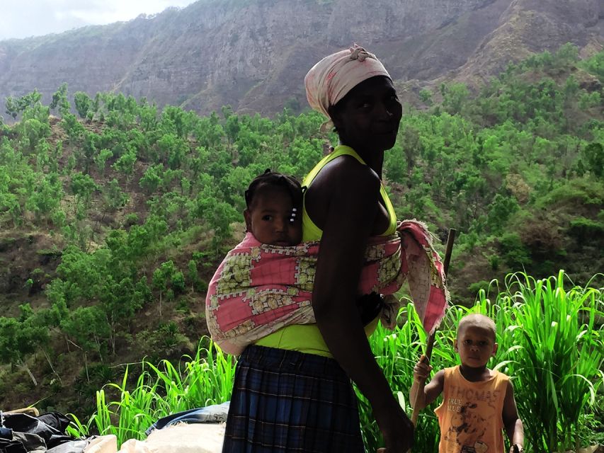
- Longueira village stops: Grogue Distillery, a look at the primary school, and time at Lemba Lemba Bar
- Pico de Antónia viewpoints: São Jorge Valley panoramas, with possible sight of Maio Island and Fogo’s volcano
- Real nature watching: endemic plants and animals plus some bird species in danger of extinction
- Monte Tchota/Txota natural park finish: the hike ends in untouched space instead of a quick sightseeing drive
- Two difficulty levels in one tour: different route files, distances, and maximum elevations
- Friendly help on rough footing: guides support you on steep sections and advise on slippery descents
Santiago’s high-country hike starts in Longueira
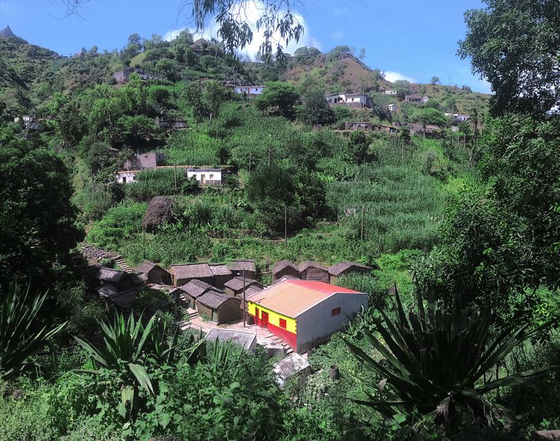
This is a guided full-morning-to-afternoon trek that begins in Praia with convenient hotel pickup. You head by transport to Longueira first, then the day turns into hiking: Pico de Antónia for the island’s top views, and later Monte Tchota/Txota for the more quiet, nature-forward ending.
The trip feels grounded because it doesn’t treat Santiago like a backdrop. You get time in a village, then you work for your height, and finally you slow down in a protected natural area.
If you like your tours to have a story, this one has a clear arc: people, rum, then altitude, then nature.
You can also read our reviews of more tours and experiences in Praia.
Longueira village: rum, a school visit, and Lemba Lemba Bar
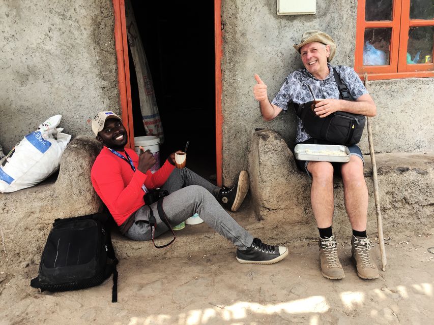
Longueira is where the day becomes more than “just a mountain.” In the village, you’re set up to meet locals directly and learn how daily life connects to the island’s flavors and routines.
A big highlight here is the Grogue Distillery. You get a look at rum-making as part of local culture, not as a museum stop. If you’re the type who likes to ask questions, this is where your guide’s conversations really matter.
The route also includes a visit connected to community life: the primary school. Then there’s Lemba Lemba Bar, which sounds simple, but in a village setting it’s often where you feel the rhythm of the place rather than just pass through.
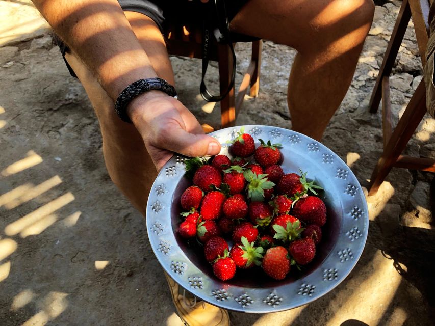
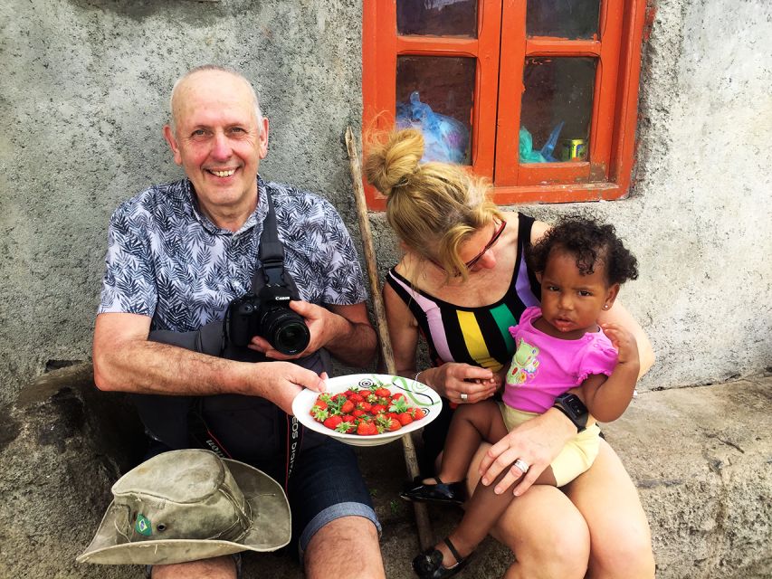
One seasonal touch: from December to May, you may walk up among the strawberry fields and enjoy a picnic. That extra walk adds charm, and it also shifts the tone from “town visit” to “working landscape.”
Pico de Antónia climb: how you earn those São Jorge views
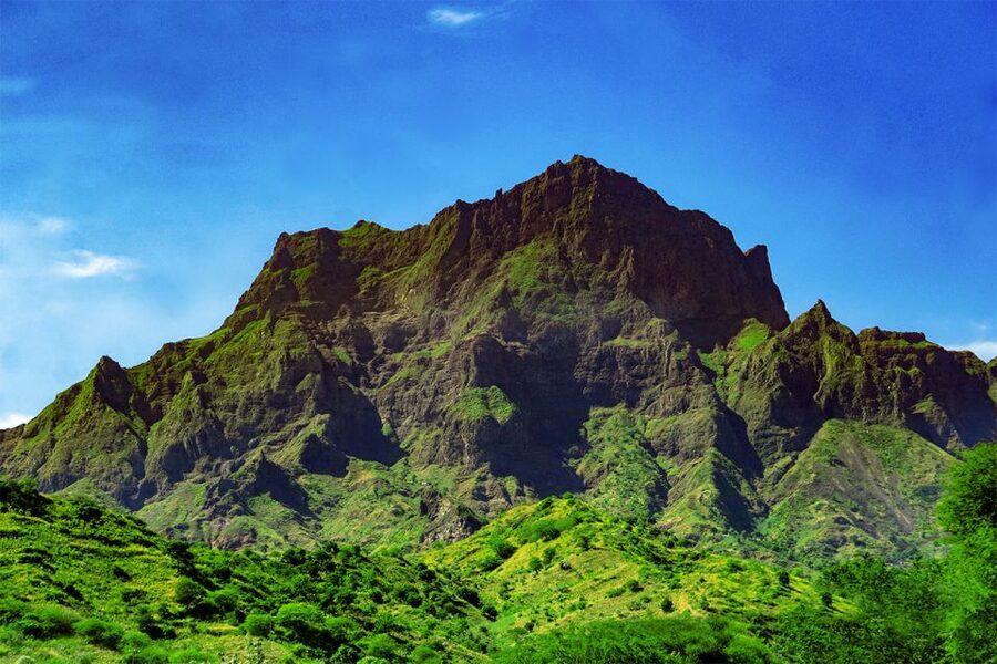
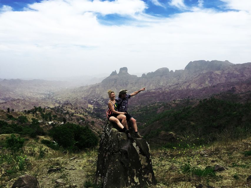
Now for the reason most people book: the climb toward Pico de Antónia, the highest point on Santiago. The walking point is listed at about 1,394 meters, and when conditions are good, the payoff is wide panoramas over the São Jorge Valley.
On a clear day, you may be able to see Maio Island and the volcano on Fogo Island. Even when weather limits distance, you still get a sense of scale—Santiago’s interior feels big once you’re climbing above it.
This climb is where the tour earns its reputation for difficulty. Expect about 5 hours uphill in the overall plan, and the tour includes a stop for a small picnic and views. Guides also tend to build in photo moments at key spots, which helps make the effort feel less like a grind.
If you’re choosing between the two route files, here’s the practical way to think about it:
- One option is longer (about 9 km total walking, ~6 hours, ~1050 m gain) with a max elevation around 1,390 m.
- The other option is shorter (about 6 km total walking, ~4 hours, ~585 m gain) with a max elevation around 1,160 m.
Both options list narrow, tilty path quality. That means you don’t just need endurance—you need controlled steps.
Monte Tchota/Txota natural park finish: where the air changes
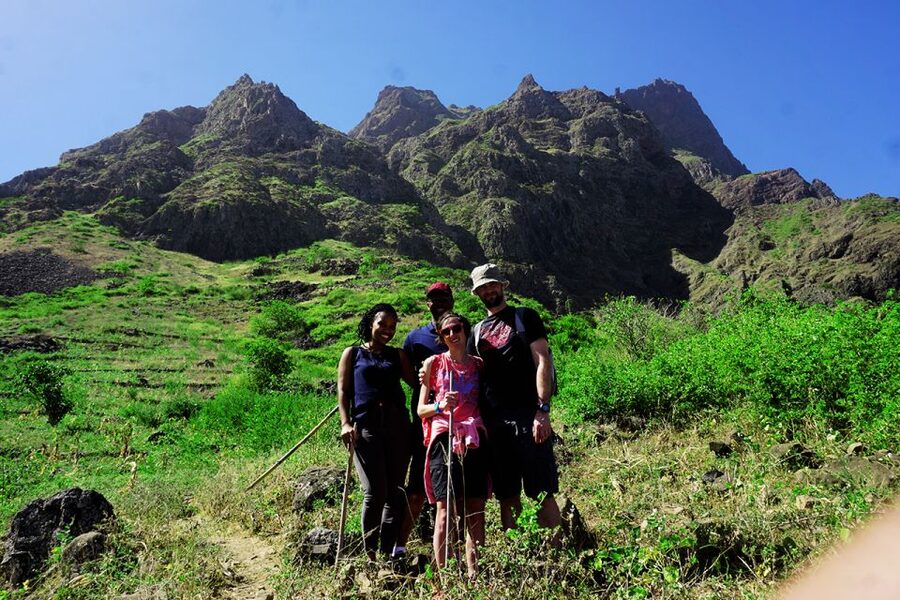
After Pico, the tour continues to the natural park of Monte Tchota/Txota. This is a meaningful shift: you go from the high-point reward to an area focused on protection of local nature.
This part matters because it slows the day down. You’re not only chasing views now—you’re looking for plants, animals, and birdlife. The tour description explicitly highlights endemic plants and animals, plus some bird species that are in danger of extinction.
That’s not “nature spotting” as a hobby; it’s more like learning what makes Santiago’s ecosystems special. When the guide points something out, you’ll notice how the park feels less like a trail corridor and more like a living habitat.
Also, ending in Monte Tchota/Txota means your day has a natural landing pad. You finish and then get dropped back to your hotel in Praia, instead of lingering on another long stretch of hiking when your legs are already done.
Difficulty, footing, and what to pack for near-vertical moments
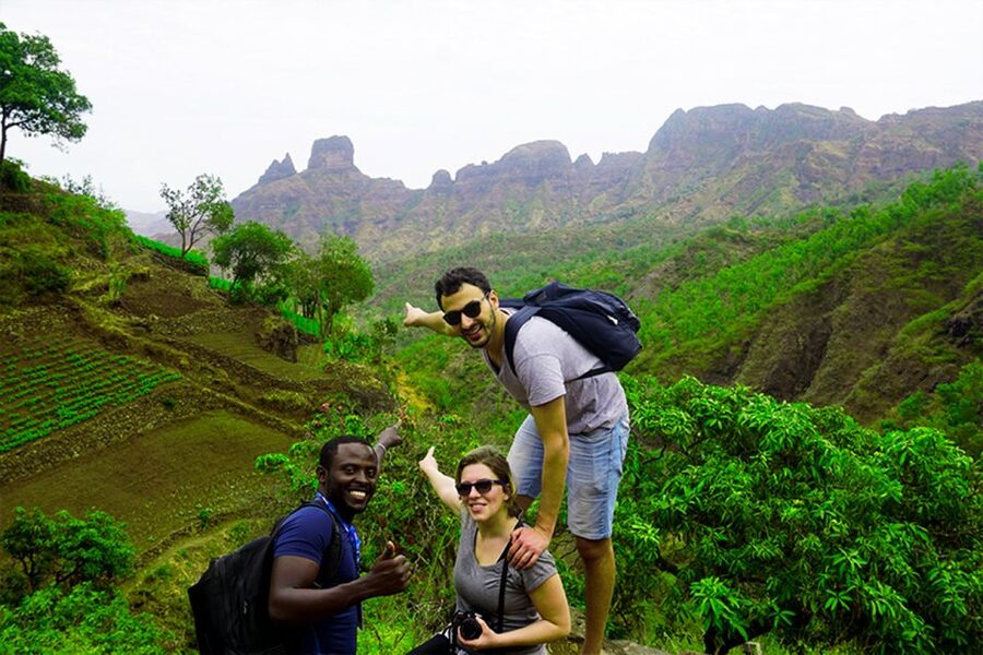
This tour is labeled Very Difficult (and it’s not for show). The elevation gain in the longer route is roughly 1,050 m, with about 600 m of elevation loss. Even the shorter route still involves big climbing and steep, narrow terrain.
The path quality is described as narrow and tilty. Translation: your feet will be busy the whole time, especially near steep sections. One review noted the last meters climb steeply, and another pointed out that the return takes longer than the climb because the ground can be very slippery.
That’s why hiking shoes aren’t optional. The tour strongly advises proper footwear, and even suggests hiking pants, especially in August to November. Walking sticks are also strongly recommended (and are mentioned as something your guide may provide).
What I’d pack based on the tour’s own list:
- Hiking shoes (bring your best grip, not your fancy shoes)
- Water
- Sunscreen
- Hat
And if you’re prone to cold hands or sunburn, plan extra. The tour runs on real walking hours, and at elevation the sun can be sharp.
Price and value: what $106 buys you on Santiago
At $106 per person, this tour isn’t cheap—but it’s not just paying for a view from a bus window either. You’re paying for a full-guided experience with hotel pickup and drop-off in Praia, transport to the trail area, and a guide throughout the hikes and village stops.
The package also includes a picnic with soft juice, a sandwich, and fruit. Add in the listed liability insurance, and you’re getting a bundled day that covers the big operational parts.
Value here comes from the mix of elements:
- Village cultural time (distillery, school, bar) rather than only hiking
- Two route files so you’re not locked into a single level of suffering
- A guide who actively helps with steep, slippery conditions, not just someone who walks a step ahead
If you want Santiago in one day with both people and terrain, this price can feel reasonable. If you’re after a gentle walk with minimal risk, you’ll likely feel the cost is too high for the effort.
Guides make or break a steep day
This trek leans physical, so the guiding style matters more than usual. The reviews you’ll find around this hike repeatedly praise guides for being friendly, professional, and attentive on tough sections.
Different guide names show up in the feedback—Ricardo, Djibril, and Admilson Garcia—and the common theme is practical help. One person highlighted that walking sticks were provided and that help was there when the ground got slippery. Another mentioned the guide knew the region well and helped with photo spots.
That aligns with what you should expect from a good mountain guide on Santiago: they manage pacing, help you handle footing, and give you enough “why this matters” so you don’t just suffer in silence.
If you get nervous about steep or narrow trails, this is the kind of tour where a supportive guide helps your brain stay calm and your steps stay steady.
Who should book Santiago: Longueira, Pico de Antónia & Monte Tchota

This is a strong fit if you check a few boxes:
- You’re an experienced hiker or at least comfortable with steep climbs.
- You can handle narrow trails and slow descents.
- You want a day that mixes community life with high-elevation hiking and nature observation.
It’s also a good fit if you like photos but hate the usual “walk to a viewpoint and back” format. The day includes multiple lookouts and photo opportunities, especially during the climb, and guides tend to show you spots worth stopping for.
I’d think twice if you:
- Are looking for a casual, low-risk outing.
- Have knee or balance issues that get worse downhill (the descent can be slippery and longer).
- Don’t have proper footwear or don’t plan to use support like walking sticks.
Should you book this trek?
Book it if you want a real Santiago hiking day: village warmth in Longueira, a high summit reward at Pico de Antónia, and a natural park finish where the guide’s spotting of endemic plants and threatened birds adds meaning.
Skip it if you want comfort over effort, or if you’re not confident on steep, narrow paths. The tour is very specific about difficulty, and the timing on the return matters.
If you’re ready to work for the views and appreciate the human side of the island, this one delivers more than a checkpoint hike. It turns into a story you can feel in your legs and remember with clear, wide perspectives from the top.
FAQ
How long is the hike?
You have two route options. One option has about 6 hours of total walking (about 9 km) and the other is about 4 hours (about 6 km).
How difficult is the trek?
The longer route is rated very difficult, and the shorter route is rated difficult. Both involve significant elevation gain and narrow trail sections.
What is the maximum elevation?
The longer route lists a maximum elevation around 1,390 meters, while the shorter route lists a maximum elevation around 1,160 meters.
Where does the tour start and end?
It starts with pickup at your hotel in Praia, and it ends with drop-off back at your hotel in Praia after the Monte Tchota/Txota natural park.
What’s included in the price?
Pickup and drop-off in Praia, transportation, a tour guide, a picnic (soft juice, sandwich, fruit), and liability insurance.
Is there a picnic?
Yes. The tour includes a picnic with soft juice, a sandwich, and fruit, with a stop for views during the hike.
What should I bring?
Bring a hat, hiking shoes, sunscreen, and water. Hiking pants are strongly advised for August to November, and walking sticks are recommended.
What languages will the guide speak?
The tour is offered in Spanish, English, French, and Portuguese.