REVIEW · LA PALMA
La Palma: Guided trekking tour to volcanoes south
Book on GetYourGuide →Operated by La Palma Transfer & Tours · Bookable on GetYourGuide
Mars-like hiking on La Palma’s southern volcanoes. You’ll start at El Pilar Refuge and follow the GR-131 trail across a volcanic world that feels otherworldly, with your guide turning the geology into real stories.
I particularly like the volcanic-activity explanations as you walk, plus the chance to photograph craters and ash-streaked slopes without rushing.
The views are the payoff: you climb past Canary pines to look over the Aridane Valley and out toward the Roque de Los Muchachos, then you reach Hoyo Negro where cloud cover can roll in like a slow white sea. And in the better-led groups, guides such as Arnie have been praised for clear information and smooth organization, including transport that actually works on a hiking day.
One thing to consider: this is a tough 17 km route with real climbing and a tough descent, so you’ll want solid fitness. Also, food and drinks aren’t included, so plan on bringing water and a simple snack.
In This Review
- Key points to know before you go
- El Pilar to Los Canarios: the Volcanoes Route’s real character
- GR-131 climb past Pico Birigoyo: views that arrive early
- Hoyo Negro crater and the cloud sea moment
- Las Deseadas, Volcán de Martín, and the descent you’ll feel
- Getting back to your day: Los Canarios finish and transfer
- Price and value: why $50 can make sense here
- Who this trek fits best on La Palma
- Small-group guiding: what you can expect from the tour style
- Weather, visibility, and when the day looks most unreal
- Should you book this volcanoes south guided trek?
- FAQ
- How long is the guided trek?
- Where does the tour start?
- How far do you hike?
- Where does the trek end?
- Is food included?
- What’s included in the price?
- What languages are the guides available in?
- Is this a large group tour?
- Can I see other islands from the hike?
- Is there free cancellation?
Key points to know before you go
- Volcanoes Route (GR-131): about 17 km from El Pilar to Los Canarios, with an ascent that pushes you close to 2,000 m.
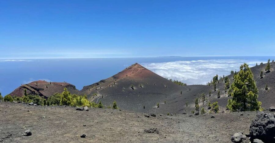
- Hoyo Negro crater + possible cloud sea: a turning point with wide views and a surreal sky effect when conditions line up.
- Pine forest meets volcanic terrain: you hike through Canary Island pines and then into younger volcanic ground with dramatic color shifts.
- Las Deseadas to Volcán de Martín: the climb’s highest point is followed by a descent that’s not easy.
- Small-group pacing: guided and structured, which helps on a route that mixes craters, ridges, and steep bits.
- Pickup and drop-off included: you lose less time on logistics and more time on the walk.
El Pilar to Los Canarios: the Volcanoes Route’s real character
This is the kind of La Palma hike that makes you slow down and look back—because the island keeps changing under your feet. The route is called the Ruta de los Volcanes, and the basic line is simple: start at Refugio El Pilar, hike along the edge of the southern mountain range, then finish at Los Canarios (Fuencaliente).
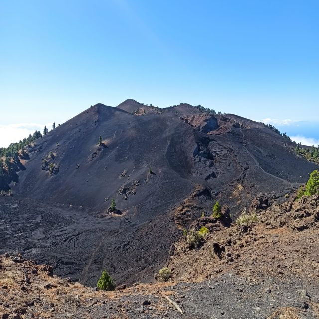
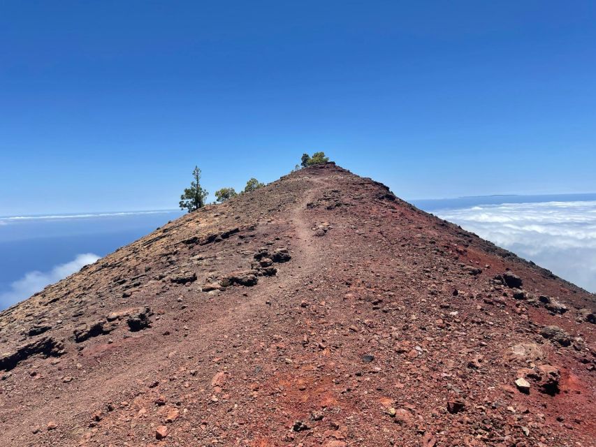
What makes it special is the mix of “big picture” and “up close.” From higher points you can see major parts of the island and, on clear days, sometimes even neighboring islands like Tenerife, La Gomera, and El Hierro. But the real wow-factor is what’s right in front of you: lava-like surfaces, ash, craters, and caldera formations—places where you’re walking across the island’s more recent volcanic history.
Duration is 8 hours, which sounds reasonable until you remember it’s not a flat stroll. You’ll be climbing from the refuge area, reaching a section near 2,000 m, and then you’ll descend. The route distance is about 17 km, and the description is blunt about one thing: it’s tough, so show up ready to work.
If you’re the kind of traveler who likes your nature with context—why it looks this way, how it formed—this is a strong match. Your guide is there for the geology, not just to point the way.
You can also read our reviews of more tours and experiences in La Palma.
GR-131 climb past Pico Birigoyo: views that arrive early
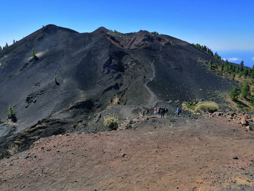
The hike begins at El Pilar Refuge, and from the start you take the GR-131 trail. Early on, you’ll walk uphill and follow a path that skirts around Pico Birigoyo. This is where the day starts giving you perspective.
One of my favorite parts of this kind of trek is when the first big viewpoints show up while you still have energy. Here, you can see the Aridane Valley as you climb, plus the Caldera de Taburiente, with the Roque de Los Muchachos in the background. Even if you’re not a professional photographer, those are the kinds of landmarks that help you understand scale—La Palma isn’t just “volcanoes,” it’s a whole system of landforms built over time.
As you move along between Canary Island pines, the mood shifts too. The greenery isn’t random—it’s a sharp contrast against the volcanic ground you’re approaching. Along the way you may spot towns and coastline areas such as El Paso, Los Llanos de Aridane, and Tazacorte. This matters because it keeps the hike grounded in real life: you’re not hiking in a vacuum. You’re walking above places where people actually live, farm, and travel through the island.
Practical thought: early elevation gained means you should pace yourself. If you start fast, the rest of the day will feel longer. If you start steady, the later craters feel more manageable.
Hoyo Negro crater and the cloud sea moment
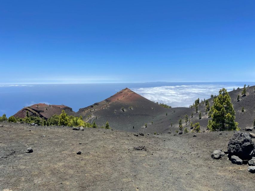
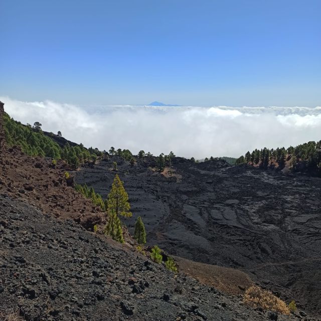
Then comes a key high point: Hoyo Negro. You’ll reach the crater and you’ll get another layer of wide views—again, conditions matter, but on clear days you might even look toward neighboring islands. The other important detail is what happens next: this section can include a walk through the cloud sea, a blanket of cloud that can spread across the area like a slow-moving ocean.
That cloud effect is more than a neat visual. It changes your perception of distance and terrain. Volcanic features that seemed sharp and obvious at the start can soften at the edges, and the whole route can feel cinematic. It’s the kind of moment that makes people say science fiction, because the world looks staged.
You’ll also notice how the route logic builds here. Hoyo Negro marks the beginning of “the many craters” you’ll encounter along the way. In other words, the hike stops being a single viewpoint drive-by and becomes crater-to-crater navigation, with the terrain constantly reshaping the path underfoot.
Photography tip that fits the conditions you might see: when clouds roll in, the lighting often turns softer and more even. That can be excellent for capturing texture in ash and volcanic rock without harsh shadows.
One caution: cloud cover can mean cooler temps and sometimes damp patches on a trail. Not every day delivers clouds, but it’s smart to be ready for a quick weather change.
Las Deseadas, Volcán de Martín, and the descent you’ll feel
After Hoyo Negro, you continue along the Volcanoes Route and reach Las Deseadas, described as the highest point of the route. From a hiking perspective, this is the stage where you should expect the “feels hard” factor to peak. It’s not just that you’re higher—it’s that you’re nearing the turning point where the day shifts from climbing to dealing with gravity on the way down.
A descent begins from Las Deseadas, and the route notes it won’t be easy. That’s useful information. Many hikes feel hardest at the top, but on this one the hard part can continue into the downhill. Descents can be rough on knees and can drain energy if you step too fast.
One of the final crater landmarks is Volcán de Martín. What makes it memorable is its impressive reddish cone, visible from afar and acting like a visual anchor for the last stretch. When you see that cone shape, the route starts to feel like a guided story arc: you’ve been passing crater after crater, and now you can clearly sense the end coming into view.
Then you’ll descend to the finish at Los Canarios (Fuencaliente). At the end of a volcanic route, I like finishing somewhere that feels like a real municipality rather than a dead-end viewpoint. Los Canarios is the place where you get your footing in the human geography of La Palma again—then the day transitions into transport back.
Getting back to your day: Los Canarios finish and transfer
This tour doesn’t leave you with the hard problem of arranging transport after a long hike. You’ll finish at Los Canarios, and a transfer back to your starting point is waiting for you. That’s a big deal on an 8-hour day because the end-of-trail logistics can otherwise turn into stress.
Also included is hotel pick-up and drop-off. Even though meeting points can vary by option, the structure is designed to make it a “do the hike, then go back” experience rather than a puzzle you solve alone.
In terms of how the day feels, the best part is mental. Once you know transport is handled, you can focus on pacing and staying steady toward the end, instead of worrying about buses and timing when your legs are tired.
If you’re traveling as a couple, friends, or solo and you want a guided day that still feels like a real hike (not a half-day shuffle), this format works well.
Price and value: why $50 can make sense here
The price is listed at $50 per person for an 8-hour guided hike. That’s not just “cheap hiking.” The value comes from what’s wrapped in:
- A live guide who explains the island’s volcanism while you walk.
- Hotel pickup and drop-off, which saves time and local-transport hassle.
- Small group hiking, which usually makes it easier to move at a safe, human pace on steep and crater-heavy terrain.
The trade-off is what’s not included: food and drinks. So you should think of the final cost as $50 plus your own simple trail plan (water and snacks). When you budget that in, the tour still looks fair for a full-day guided experience.
If you’re the type who’d otherwise spend money on transit, a self-guided route, and a guide for interpretation, the included guide time is where your value is strongest.
Who this trek fits best on La Palma
This is an excellent tour for people who want the classic La Palma magic: volcanoes, views, and guidance all in one day.
You’ll be happiest if:
- you’re in good physical condition and ready for a tough 17 km route
- you like a guided hike where the guide connects what you see to volcanic history
- you care about scenery that’s more “science fiction” than “storybook postcard,” especially around craters like Hoyo Negro and Volcán de Martín
You might reconsider if you:
- want something gentle or mostly flat
- dislike long descents (this route flags that downhill is not easy)
- don’t want to bring your own snacks and water, since food and drinks aren’t included
Language-wise, you’ll have options: your live guide supports Spanish, English, and German. That matters because the explanations about volcanism are part of the experience, not just the hiking logistics.
Small-group guiding: what you can expect from the tour style
A small group changes the feel of a long day. It’s easier to ask questions, easier to adjust pace when the terrain gets tricky, and easier to keep together when you’re walking along a route with craters and changing viewpoints.
Guide quality is also a highlight from past experiences. One guide named Arnie was praised for excellent guidance and interesting information about the island’s volcanic activity, with transport described as perfectly arranged. The takeaway for you is simple: you’re not just buying a route, you’re buying interpretation plus on-the-day organization.
If you care about learning while you hike, that’s what you’ll feel: the science and the visuals work together.
Weather, visibility, and when the day looks most unreal
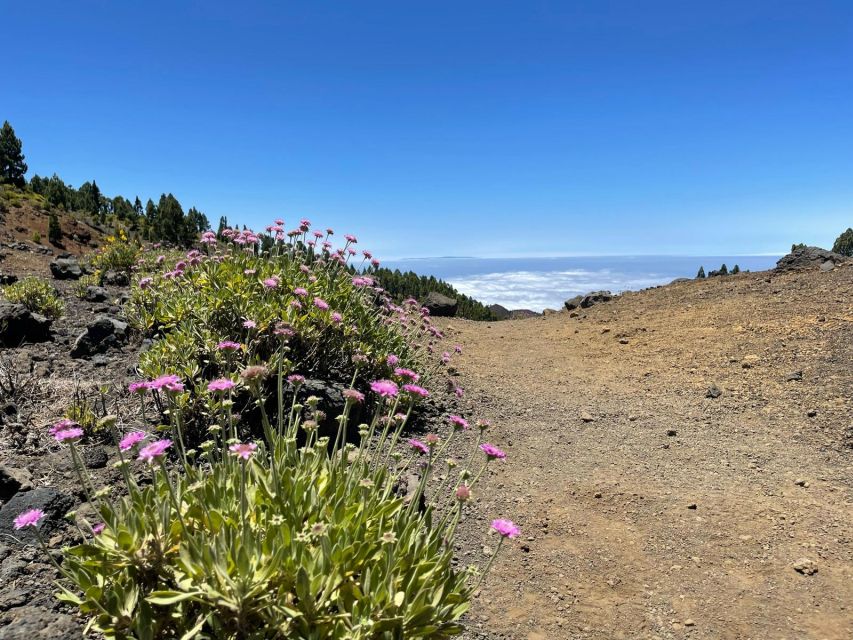
The route mentions that on some days you may be able to see other islands in the province—Tenerife, La Gomera, and El Hierro—depending on the day. It also mentions the possibility of the cloud sea near Hoyo Negro.
So the “best” day isn’t only about sunshine. Clear visibility makes long-distance views possible, while cloud conditions can create that otherworldly, Mars-like layer. You can’t force either, but you can set expectations: you’re hiking in a volcanic high area where conditions can change.
Should you book this volcanoes south guided trek?
Book it if you want a full-day, guided volcano hike that feels like walking through a real-life geology lesson. The combination of El Pilar Refuge to Los Canarios, the GR-131 route, crater highlights like Hoyo Negro and Volcán de Martín, and panoramic opportunities (sometimes even other islands) gives you a lot of return for the money.
Don’t book it if you’re looking for an easy walk or you’re not ready for a tough 17 km day with an uphill start and a downhill finish. Also, remember to plan for food and drinks, since you’ll need your own trail fuel.
If your goal is a memorable La Palma day that blends big views with volcanic detail—and you can handle the physical side—this one is worth a spot.
FAQ
How long is the guided trek?
The duration is listed as 8 hours.
Where does the tour start?
It starts at Refugio de El Pilar.
How far do you hike?
The Volcanoes Route is described as about 17 km.
Where does the trek end?
The final point is Los Canarios (Fuencaliente).
Is food included?
No. Food and drinks are not included.
What’s included in the price?
The tour includes hotel pick-up and drop-off and a guide.
What languages are the guides available in?
The live guide is listed in Spanish, English, and German.
Is this a large group tour?
No, it’s a small group option.
Can I see other islands from the hike?
Depending on the day, you may be able to see Tenerife, La Gomera, and El Hierro.
Is there free cancellation?
Yes, you can cancel up to 24 hours in advance for a full refund.