REVIEW · KAMPALA
Rwenzori Mountains Trekking with Margherita Peak Summit
Book on Viator →Operated by Bujuku Eco Tours & Travel Ltd · Bookable on Viator
Fog, glaciers, and mountain quiet. This Margherita Peak trek takes you deep into Rwenzori Mountains National Park, where equatorial forests turn into giant heather, lobelia, and groundsel at high altitude. I like that it is built as a real hiking circuit, not just a one-day challenge.
What really sells it is the hands-on trail support and smooth trip rhythm. In the team’s reported track record, guides including Johnson and Geofrey are repeatedly praised for keeping logistics tight, communication clear, and the experience comfortable even when the trail is tough.
One big consideration: summit day involves an exposed, slippery glacier approach and you’re not getting climbing gear included. If you’re short on time, money, or experience with cold, wet conditions, you’ll want to plan extra carefully.
In This Review
- Quick hits before you go
- Rwenzori’s “Mountains of the Moon” feel: why this trek is worth your week
- What makes Margherita Peak special (and not just tall)
- Route at a glance: where the trek takes you over 7 days
- Day 1: Nyakalengijja to Nyabitaba Hut (forest, river crossings, first ridge burn)
- Day 2: Nyabitaba down to Kurt Shafer Bridge, then up through mossy rock
- Day 3: Bujuku Lake and the bog lesson (Lower Bigo Bog to Bujuku Hut)
- Day 4: Through Groundsel Gully to Elena Hut or Kitandara Hut
- Day 5: Margherita Peak (5,109m) summit push via glaciers and exposed rock
- Day 6: Freshfield Pass (4,282m) and the Congo view window
- Day 7: Kichuchu cliffs, bamboo river crossings, and finishing at Mihunga Gate
- Wildlife, plants, and what to watch for on the trail
- The $1,400 value question: what you’re paying for (and what you’re not)
- Practical tips that matter for this specific route
- Who this trek fits best
- Should you book this one?
- FAQ
- Where do I meet for this trekking tour, and where does it end?
- How long is the trek?
- What is the summit you’re aiming for?
- How long does the Margherita summit attempt take?
- What meals are included?
- Is climbing gear included?
- Is pickup offered?
- Is this tour private?
- What fitness level do you need?
- Can I cancel for a full refund?
Quick hits before you go
- Margherita Peak (5,109m) summit day: expect a steep, glacier-crossing push of about 4–5 hours depending on weather and pace
- Bog walking training: Lower and Upper Bigo bogs are part of the route, with cold, squishy steps built in
- Wildlife and Albertine Rift endemics: chimpanzees (often heard), colobus monkeys, and the Rwenzori turraco are part of the mix
- Huts and camps every night: sleep at named locations like Nyabitaba, John Matte, Bujuku, Elena, Kitandara, and Guy Yeoman
- Private trek format: only your group participates, which helps the schedule feel more personal
- Park entry is free here: the trek days list admission ticket free, so you’re not paying extra for entry
Rwenzori’s “Mountains of the Moon” feel: why this trek is worth your week
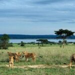
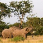
The Rwenzori Mountains don’t look like typical African peaks. You’re in the tropics, but the higher you go, the more the world changes: forests thin, mist becomes normal, and alpine plants take over. The park protects the highest stretch of a long, rugged mountain range, and it’s known for wildlife variety and rare vegetation tied to the Albertine Rift.
That matters because you’re not just “climbing for a view.” You’re moving through zones with totally different textures underfoot—thick forest along the Mubuku River, then bamboo, then mossy slippery rock, then bogs, then high alpine ground. If you’re the type who gets excited by small details, this route keeps feeding that habit.
You can also read our reviews of more tours and experiences in Kampala.
What makes Margherita Peak special (and not just tall)
Margherita Peak is the high point of this trek, topping out at 5,109m. The summit attempt is not described as a long hike—it’s more like a focused mountaineering-style day. To reach the top, the climb takes about 4–5 hours depending on weather and pace.
The route to the summit includes crossing three glaciers, plus slippery rock, ice, and exposed sections open on many sides. That’s the key: you’re not simply walking up a trail. You’re moving in a cold, technical environment where weather can change fast, and footing demands respect.
So the “value” of this summit day is two-fold. You get the highest target, and you also get a trek that prepares your body for altitude and conditions through earlier bog and high-zone days.
Route at a glance: where the trek takes you over 7 days
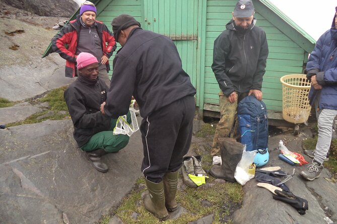
This trek is set up as a circuit through Rwenzori Mountains National Park, with named overnight stops. You start with a briefing and equipment organization, then you gradually climb into higher vegetation zones before turning your focus to the summit push and the return.
You’ll also notice the route alternates between strain and relief. Some days are long and steep through forest or rocky stretches. Other days (like the acclimatization-focused day around the lake and huts) are shorter so you can adjust before the cold heights get serious.
Day 1: Nyakalengijja to Nyabitaba Hut (forest, river crossings, first ridge burn)
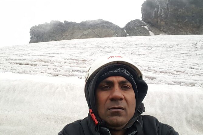
Day 1 begins at Rwenzori Mountains National Park with a drive to Nyakalengijja for briefing and equipment setup. From there, the trail starts by passing farmland, then moves into thick forest along the Mubuku River.
Soon you cross the Mahoma River tributary and start a long, steep climb up onto a ridge toward Nyabitaba Hut. Expect the first real work of the trip—listed as about 6–7 hours—and a solid altitude climb into the first camp zone.
Wildlife and bird life can show up early. The walk may include chimpanzees (often heard), plus sightings like black-and-white colobus, blue monkey, and the Rwenzori turraco. Even if you don’t tick off everything, Day 1 sets the tone: you’re in deep, green country before alpine air takes over.
Day 2: Nyabitaba down to Kurt Shafer Bridge, then up through mossy rock
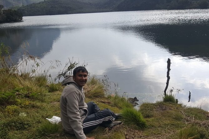
Day 2 drops through the forest toward Kurt Shafer Bridge, just below where the Mubuku and Bujuku rivers meet. You then pass through a bamboo forest, which is a nice change from the heavier tree cover of Day 1.
After the bamboo, the day turns into an “old-school trekking” section: a long, exhausting stretch of slippery, moss-covered rock. This is the kind of footing that punishes rushed steps. I like that it forces you into good rhythm early—slow, careful, and controlled.
Later, the Nyamuleju rock shelter gives views of Mount Stanley and Mount Speke. Then you transition into higher altitude plant zones: giant heather, lobelia, and groundsel. You finish at John Matte Hut for dinner and overnight, with a hike time of about 7–8 hours.
Day 3: Bujuku Lake and the bog lesson (Lower Bigo Bog to Bujuku Hut)
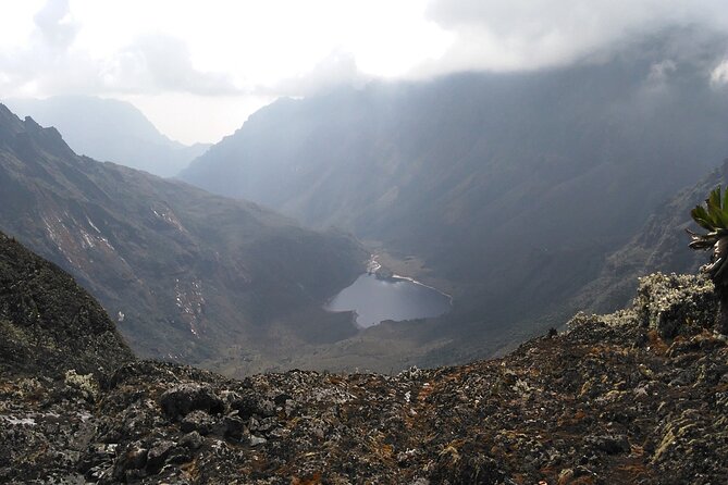
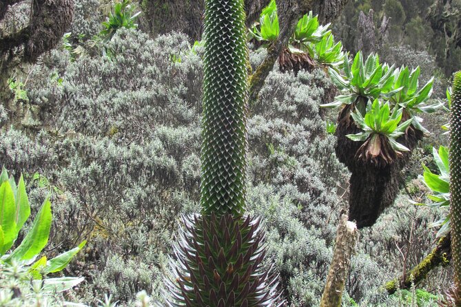
Day 3 is shorter on the clock—about 4–5 hours—but it’s still mentally intense. You cross the Bujuku River, then enter Lower Bigo Bog, known for giant lobelias.
The bog crossing is described as moving from tussock to tussock. Real talk: it rarely stays dry. Your feet may touch freezing ooze below, so pace matters more than speed. If you’re prone to panic when things get slippery, practice calm breathing here. It’s not optional.
Once the bog is crossed, the route opens toward Upper Bigo Bog and then Bujuku Lake. The views listed include Mount Baker to the south and Mount Stanley to the west. You reach Bujuku Hut, tucked in a narrow valley under Mount Baker and Mount Speke.
This day is also an important acclimatization moment for people attempting peaks like Mount Stanley and Mount Speke. Even if your single target is Margherita, you benefit from the built-in adjustment time.
Day 4: Through Groundsel Gully to Elena Hut or Kitandara Hut
Day 4 is a hinge day: you’re leaving Bujuku and moving higher toward the summit zone. The route continues through more bog, then climbs steep slopes west of the lake and travels through Groundsel Gully.
Then the path splits. The trail on the right rises to Elena Hut with views toward Mount Stanley, using a steep route over large boulders. The left-hand option leads to Kitandara Lakes and Kitandara Hut, which is for those not climbing Margherita on this itinerary.
For Margherita climbers, dinner and overnight are at Elena Hut. The description calls it cool and icy, which is a useful warning: you’re not just hiking—you’re sleeping in conditions that prep your body for colder air.
Hike time is listed as about 5–6 hours, with a 579m elevation height figure noted for the day. Translation: you’re not trying to “win distance” today. You’re setting up for tomorrow.
Day 5: Margherita Peak (5,109m) summit push via glaciers and exposed rock
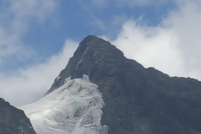
This is the day people remember. Early start, then a 4–5 hour climb to Margherita depending on weather and pace.
The summit route is described as tough and includes three glaciers. That means slippery, technical travel over ice and exposed areas open on many sides. If the weather is foggy or conditions are icy, you’ll feel it in your nerves as much as your muscles.
The good news: you’ve already been spending days in the right kind of environment—forest to bamboo to mossy rock to bogs to high alpine zones. Your body has a chance to adapt before the cold, exposed sections appear.
You scramble up to Margherita Peak, the highest point of the Rwenzori Mountains in this trek’s framing. Then you descend from Margherita back to Elena Hut in about 2–3 hours.
Even if you’ve done tough hikes before, keep this day in the “mountaineering effort” bucket, not the “long walk” bucket.
Day 6: Freshfield Pass (4,282m) and the Congo view window
Day 6 moves from the higher camp zone toward Freshfield Pass, listed at 4,282m. The trail starts by ascending steeply up the headwall from the Mount Baker base area, then follows along the south side of the mountain.
At Freshfield Pass, the views expand fast. You can view into the Congo to the west and Mount Stanley to the north. This is one of those moments when the route feels like it’s earning every step.
After the pass, the trail becomes a long stretch of high alpine mossy ground. Then you start descending through steep rocky trails to Bujongolo rock shelter, noted as the base camp for the historic expedition by the Duke of Abruzzi in 1906.
You end with an overnight at Guy Yeoman Camp. The listed hiking time is 6–7 hours. In plain terms: after summit day, this isn’t meant to be easy—but it’s a controlled continuation rather than another all-out push.
Day 7: Kichuchu cliffs, bamboo river crossings, and finishing at Mihunga Gate
Day 7 is the final unwind, but it’s not a gentle stroll. You descend the cliffs of Kichuchu, then continue on a muddy path that crosses the Mubuku River twice through a bamboo forest.
After that, you climb downwards to Nyabitaba, completing the circuit. Then the route continues descending Nyabitaba Camp and you finish the trek by evening at Mihunga Gate.
This descent is listed as 7–8 hours, which is a reminder that the “hard part” doesn’t end when you reach the highest point. Your legs do the last job here.
Wildlife, plants, and what to watch for on the trail
The Rwenzori experience is tightly linked to its altitude-driven ecology. The park is home to a large number of mammals and birds, including Albertine Rift endemics and rare vegetation.
On the ground, you’ll move through zones where the dominant plants change quickly:
- thick forest and river corridors early on
- bamboo forest mid-route
- moss-covered rock and slippery footing
- bogs with giant lobelias
- giant heather, lobelia, and groundsel at higher elevations
- high alpine mossy zones near the pass
Wildlife sightings aren’t guaranteed, but the trek description gives good “watch points.” Day 1 is where chimpanzees may be heard and where colobus monkeys and blue monkeys could appear. Birdlife includes the Rwenzori turraco.
My advice: don’t just scan for animals. Watch how the trail surface changes. In Rwenzori, the trail itself is a living clue about where you are in elevation.
The $1,400 value question: what you’re paying for (and what you’re not)
At $1,400 per person for a roughly 7-day trek, you’re paying for a lot more than a guided walk.
What you get in the provided details:
- meals: breakfast (7), lunch (7), dinner (7)
- private operation: only your group participates
- pickup is offered
- park admission ticket is listed as free in the daily outline
- the itinerary includes multiple overnight points in huts/camps with the trek structure to match
What you don’t get:
- climbing gear is not included
So the value is strongest if you already have the climbing gear you need (or a clear rental plan). If you must purchase gear locally, your true trip cost may rise.
Also, value isn’t only price. In past trekkers’ notes about this operator, the strongest praise clusters around professional guiding, fast communication before the trek, flexibility for health-related changes, and overall organization. That’s exactly what you want when you’re walking for hours on slippery rock and then dealing with cold, exposed conditions.
Practical tips that matter for this specific route
This trek includes bog crossings, mossy slippery rock, and glacier travel. So your “success factors” are simple: traction, layers, and calm.
- Take bog sections slow. Rushing is how you twist a knee.
- Plan for cold. Elena Hut is described as cool and icy, and summit conditions can be exposed.
- Don’t assume footwear alone replaces traction needs. If your gear plan is weak, the glacier day will feel like a surprise exam.
- Bring a steady walking mindset. The route is long on travel days even when hike time is shorter (Day 7 is the example).
- If you’re working with the operator, ask early about what counts as climbing gear for your summit day and what you must carry yourself.
Who this trek fits best
This is best for hikers who want a real mountaineering-style experience, not a relaxed nature walk. The tour data asks for moderate physical fitness, but Margherita summit day includes exposed, glacier-crossing travel. So think “moderate fitness plus serious respect for altitude and cold.”
It also fits well if you prefer a private schedule for your group. Private format helps the pace feel less like a cattle-line trek, and it gives your guide room to adjust timing to conditions.
Should you book this one?
If your goal is Margherita Peak at 5,109m, and you’re ready for technical conditions, this trek is a strong choice. The route is built around real acclimatization days, distinctive plant zones, and named camps that make the week feel structured.
I would hesitate only if you’re not prepared to handle cold, slippery travel and you don’t have a plan for climbing gear. Since that part is not included, it’s the main “gotcha” that can turn a great plan into an expensive scramble.
FAQ
Where do I meet for this trekking tour, and where does it end?
The tour start is listed as Entebbe Airport (Entebbe Uganda), and it ends back at the meeting point.
How long is the trek?
The trek is listed as 7 days (approx.).
What is the summit you’re aiming for?
The tour is centered on the summit of Margherita Peak (5,109m asl).
How long does the Margherita summit attempt take?
The climb to the summit is listed as about 4–5 hours, depending on weather conditions and pace.
What meals are included?
The trek includes breakfast (7), lunch (7), and dinner (7).
Is climbing gear included?
No. Climbing gear is not included.
Is pickup offered?
Yes. Pickup is offered.
Is this tour private?
Yes. It is listed as a private tour/activity, with only your group participating.
What fitness level do you need?
You should have a moderate physical fitness level.
Can I cancel for a full refund?
Yes, free cancellation is offered. You can cancel up to 24 hours in advance for a full refund, and cancellations inside that window are not refunded. The listing also notes that if a minimum traveler requirement isn’t met, you’ll be offered a different date/experience or a full refund.